Aligning the 360° panorama background to Terrain level
Maurice2017-05-19 15:13:59
Here's a new technical support issue that I wanted to share with our Edificius users.
Question: In the RTBIM view the terrain part in my 360° pano photo isn't aligned with the terrain set up in my model. Is there a way of fixing this?
Answer: To align the modelled terrain to the terrain in your 360° pano photo, simply proceed as follows: 1] Open the RTBIM (Real Time rendering) View; 2] Using your computer's "Ketboard", keep the "Ctrl" key pressed; 3] Now press "Pag UP" and/or "Pag DOWN" to "raise" and "lower" the terrain level in relation to the rest of the model; 4] continue to adjust the elevation until the desired result is obtained.
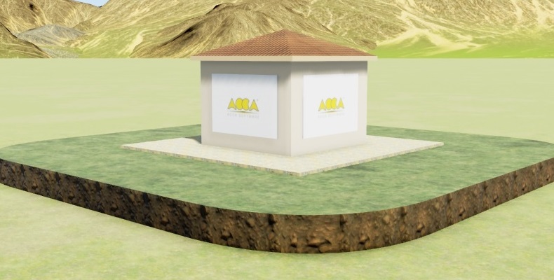
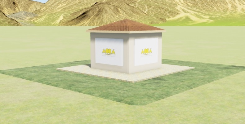
Here are a few examples showing the adjustments made "BEFORE" and "AFTER" the alignment process:
Can you try again with the Arrow up and Arrow down keys. If on a Laptop, please be sure to have the appropriate keysets active - this normally can be achieved with the FN Key (bottom left).
If you are still experiencing problems with Terrain offset in Real Time Rendering, please let me know which kind of Pc or Laptop you are using.
By accessing and using our website services you implicitly accept the use of cookies to improve navigation and show content in line with your personal preferences. Info OK